Our methodology and data models
Accredited methodology
Granularity of data
Scientific approach
Our engineering team continuously fine-tunes our models with reliable primary data. If discrepancies arise, we adjust the models to ensure accuracy and transparency.
Network optimization
Evaluate data outputs with
Dynamic API results based on your inputs
The information you can provide are a crucial part of our CO₂e calculation models. Our ability to enhance data modeling depends also on your data inputs.
To offer you the utmost accuracy in your carbon emissions, our methodology and powerful algorithms include:
- Terrestrial and Satellite AIS data
- Extensive base of carriers schedules
- Vessels technical and operational information
- Information on traffic separation schemes, piracy areas, and port entries
- Fuel type analysis, including emission control areas at sea (ECA/SECA)
Factors Model
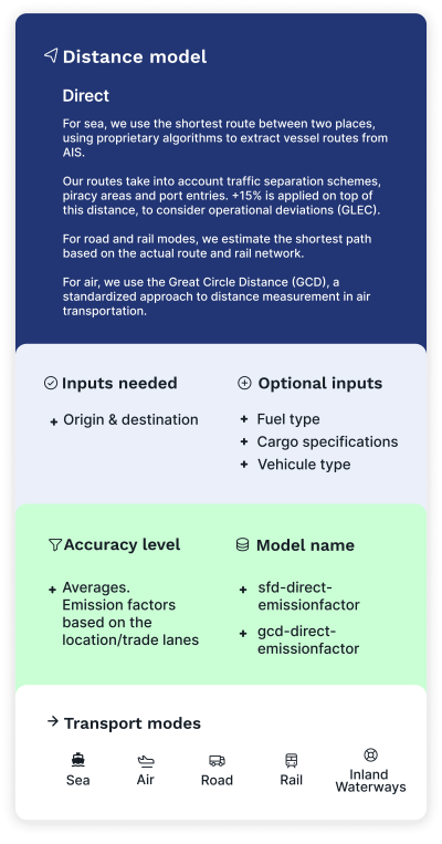
We use the latest GLEC version and ISO compliant emission factors to compute CO₂e emissions between two locations, for any mode of transport.
Elements considered:
- Shortest feasible distance
- Tradelanes emissions factors
- Cargo characteristics (size, weight, dry or reefer, etc.)
- Fuel types (and fuel switch for emissions control areas at sea)
- Vehicule type (air, road and barge)
- For air: GLEC emission factors based on the length (short, medium, long haul) of the flight and the aircraft type (passenger, cargo or unknown).
Schedules Model
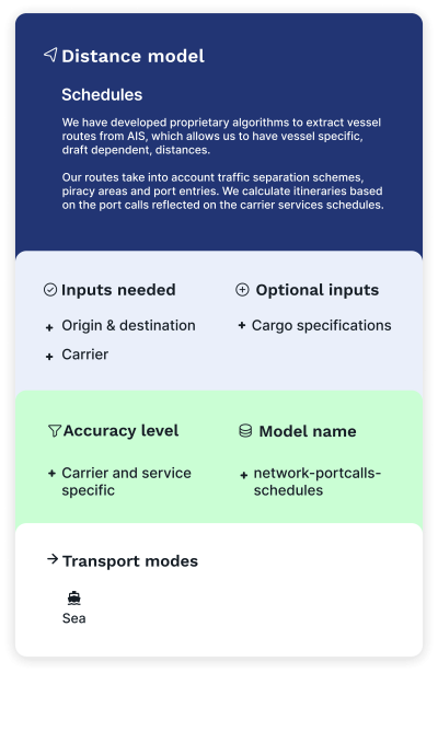
This endpoint has been specifically designed to help shippers make the best decisions when choosing carriers solutions. We calculate the itineraries operated by the carrier based on their services (and their alliance) and for each, we compute the CO₂e emissions of each vessel operating, and return the statistics.
Elements considered:
- Network distances
- Cargo characteristics
- Fuel consumption model considers the engine characteristics of the vessel, its fuel types, and fuel switch for emissions control areas, and the vessel characteristics for the allocation of the emissions.
Ship Model
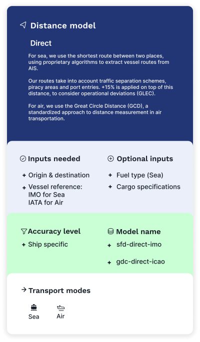
This solution returns CO₂e emissions between two locations, taking into account the exact characteristics of the requested ship to model its fuel consumption.
Elements considered:
- Shortest feasible distance
- Cargo characteristics
- For sea, fuel consumption model considers the characteristics of the vessel, fuel types, and fuel switch for emissions control areas.
- For air, fuel consumption model considers take-off, landing, climbing, descent and cruising phases, and the aircraft characteristics for the allocation of the emissions (EEA/EMEP methodology and EUROCONTROL data).
Historical Model
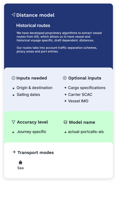
This endpoint is designed to report emissions for shipments based on the vessel itineraries computed from historical AIS data. Depending on your input, we return the CO₂e emissions on vessel level, carrier level, or industry level.
Even if you don’t have all the information in hand, we can make the most out of it. We’ll compute the most likely itineraries and vessels operated at a specific date, and return the CO₂e statistics for it.
Elements considered:
- Actual distances
- Port calls operated at a specific date for each vessel
- Connecting vessels
- Cargo characteristics
- Fuel consumption model considers the engine characteristics of the vessel, its fuel types, and fuel switch for emissions control areas, and the vessel characteristics for the allocation of the emissions.
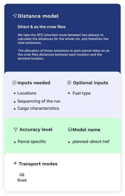
Parcel Model
This endpoint was specifically designed for milk run operations. It computes and assigns the right emissions to each order (parcel) of a pickup and delivery collection by road.
This model, based on the HBEFA (handbook emission factors for road transport data), takes into account empty running distances along with load factor between each pickup/delivery location.
Elements considered:
- Shortest feasible distance between each location
- As the crow flies distances between each location and the terminal location
- Sequencing of the run
- Cargo characteristics
- Fuel type